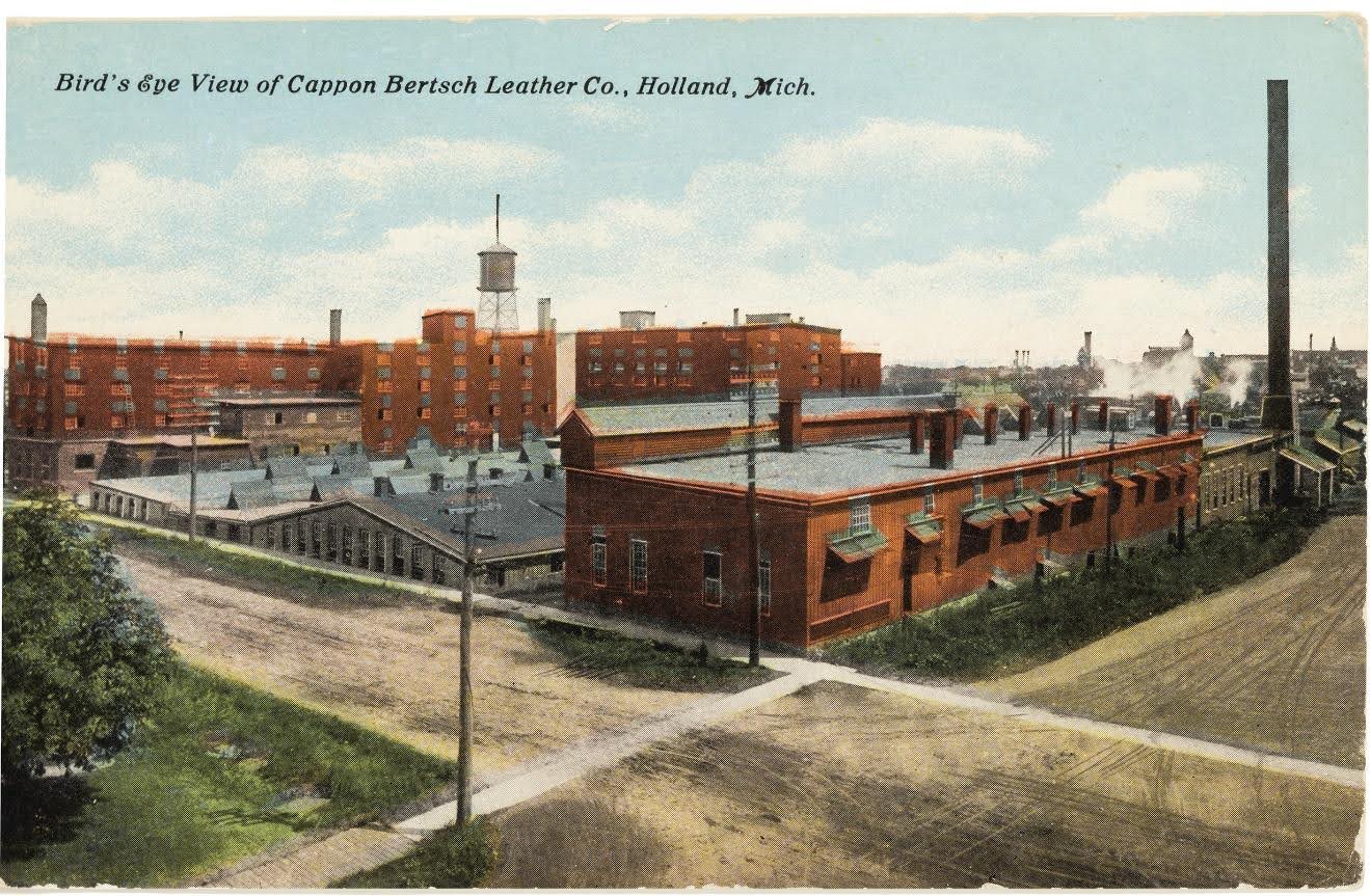
If you reached this site by scanning the QR Code on the marker at the WSN Garden in Holland, you already know some of the history of Tannery Creek. It was once a free-flowing creek and was chosen as a site to open the Cappon and Bertsch tannery, a major industry in Holland’s early economy.
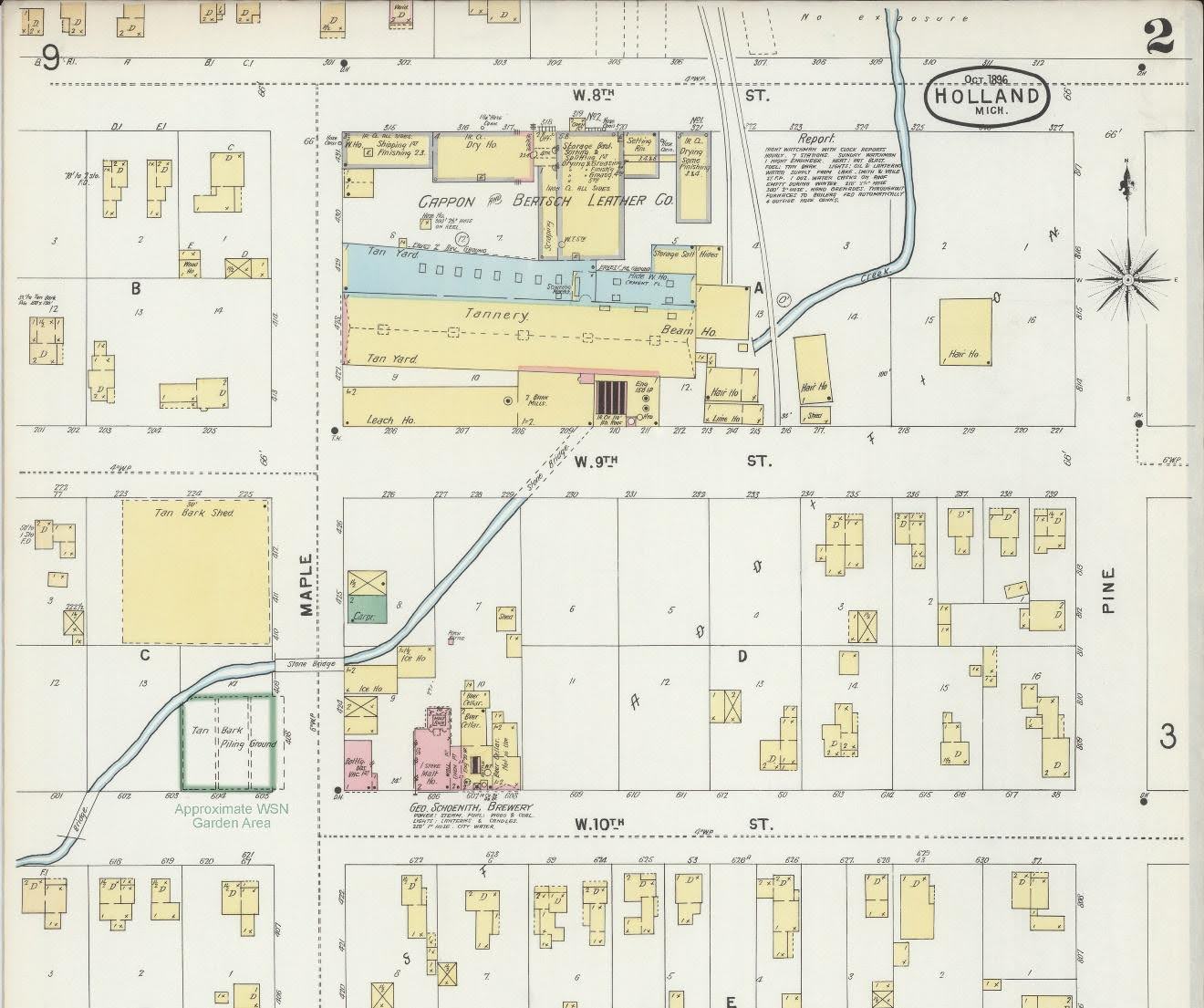
The 1896 map below shows the extent of the Tannery which opened on the site in1859. Sanborn Fire Insurance maps were produced for many cities and are a wonderful resource for understanding history as they were updated periodically well into the early 20th Century. The Library of Congress has a substantial collection of these maps spanning multiple years. Many of the maps are part of their digital collection and available for online viewing at www.loc.gov.
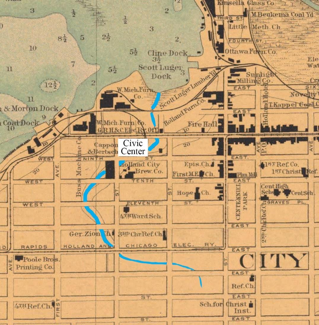
Another view of the creek (emphasized in blue) can be seen on this 1908 Holland Harbor map. The current Holland Civic Center location has been added on the map, replacing the tannery, to help reference today’s urban landscape.
Although the creek has been completely covered over or enclosed in culverts, you can still get a sense of the old stream bed by taking the sidewalk located west of St. Francis Church south from 12th Street. Looking west you can see the depression behind the duplex which was never filled in. Also, the slope eastward down 10th Street and north to the Civic Center are all reminders of this significant topographic feature.
Thank you for your interest in Tannery Creek. If you like local history you may enjoy a visit to the Holland Museum and Archives. It is located only a few blocks away at 31 West 10th Street.